



Helping forest officials efficiently manage their workload

Role
Duration
Industry
Team
Responsibilities
Gudalur, a region in India, is home to approximately 30,000 residents and a diverse wildlife population, notably featuring elephants. The forest officials in this area safeguard these elephants from poachers while ensuring the safety of the locals. A typical day for them involves monitoring and reporting details about elephant herds in specific regions twice a day and alerting residents about elephant movements when elephants approach human habitat areas.
Challenge
Manual logging of elephant counts poses challenges in storing and accessing information. Additionally, alerting people about elephant movements often took too long, endangering the safety of residents in some instances.

Forest officials
Forest rangers
Residents
The journey began with on-field research, during which our team observed, immersed, and interviewed people from the surroundings. Once we gained sufficient insights into the situation from the perspectives of the rangers, officials, locals, and other user groups, we conducted an affinity diagramming workshop. This workshop included a few selected representatives from all user groups to organize our research findings and identify themes and opportunities.
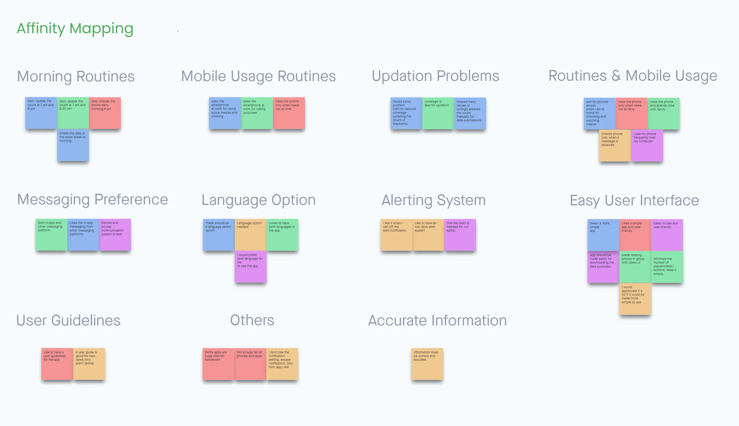
Our research findings highlighted major challenges for the officials while alerting the locals, tracking elephant movements, and managing their workload overall.
Inefficient alerting process
Alerting users about elephant movements involved multiple decision-makers before reaching locals in the affected region. In addition, the outdated SMS alert system required a dedicated operator, incurring additional costs and substantial delays in message relays. Moreover, in the absence of the operator or due to maintenance issues, alerting had to be done manually, with officials and rangers physically informing residents.
Observing users using the app helped us refine solutions to best fit their needs and situations during specific actions. We employed the Impact Effort Matrix to prioritize features for each phase of the long-term project.
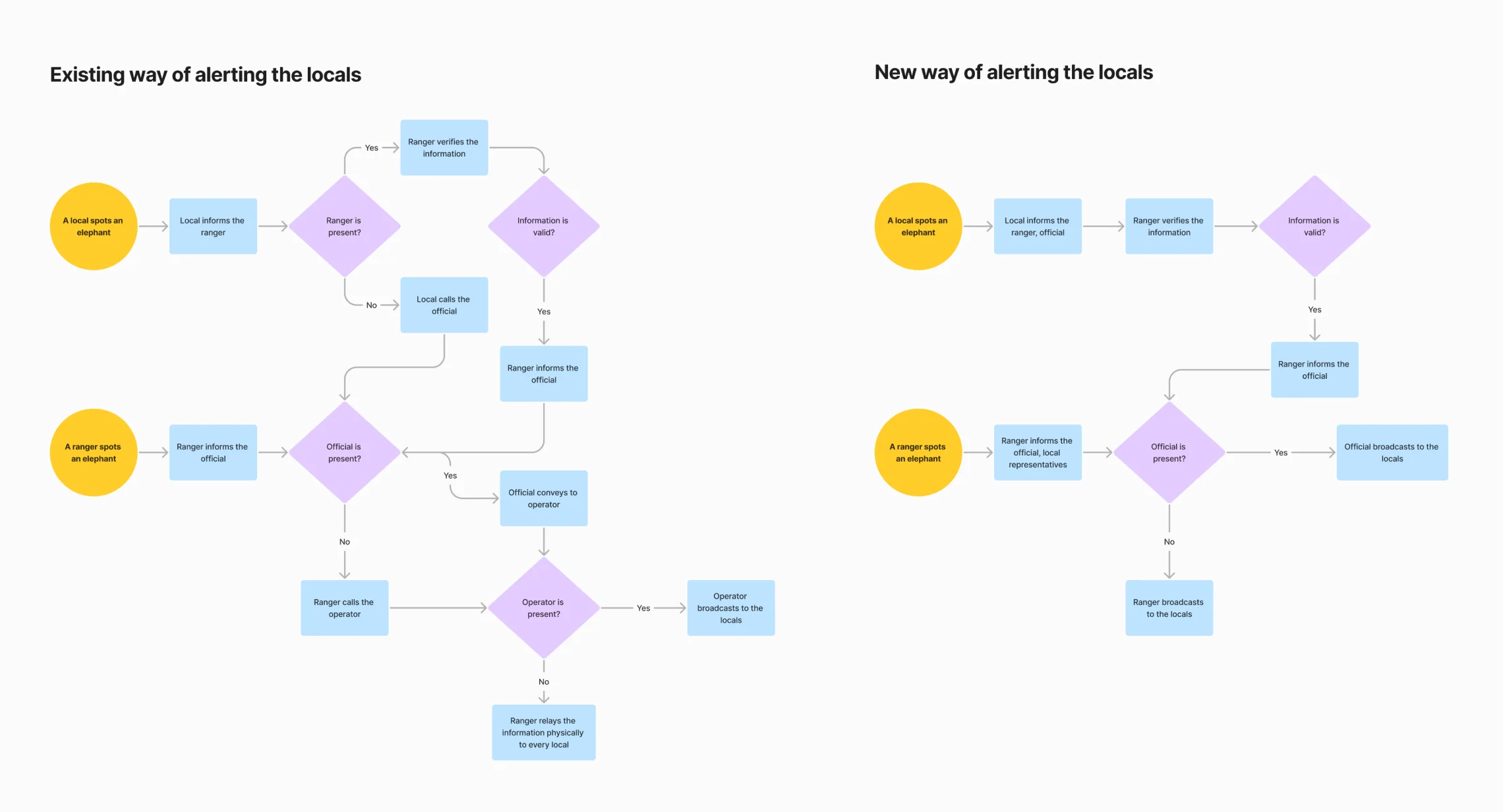
Comparison between the old and new methods of alerting locals in the event of elephants being spotted near a residential area.
Fast, streamlined alerting process
The 'Yaanai' app, accessible to locals, rangers, and officials, is a centralized communication platform between all the user groups. Anyone within the range can report elephant sightings to the key decision-maker—the forest official. The official validates this information and broadcasts the alerts to locals in the specific region from the app. Users have different hierarchies and permissions aligned with their real-world chain of command. This structure prevents the dissemination of false information and facilitates effective decision-making.
A two-day camp was organized to educate officials and selected locals about the app's functionalities and usage. Support for regional language on the app made it easy for the users to follow and take action. The app has significantly reduced the time and cost of managing and reporting data for the officials.
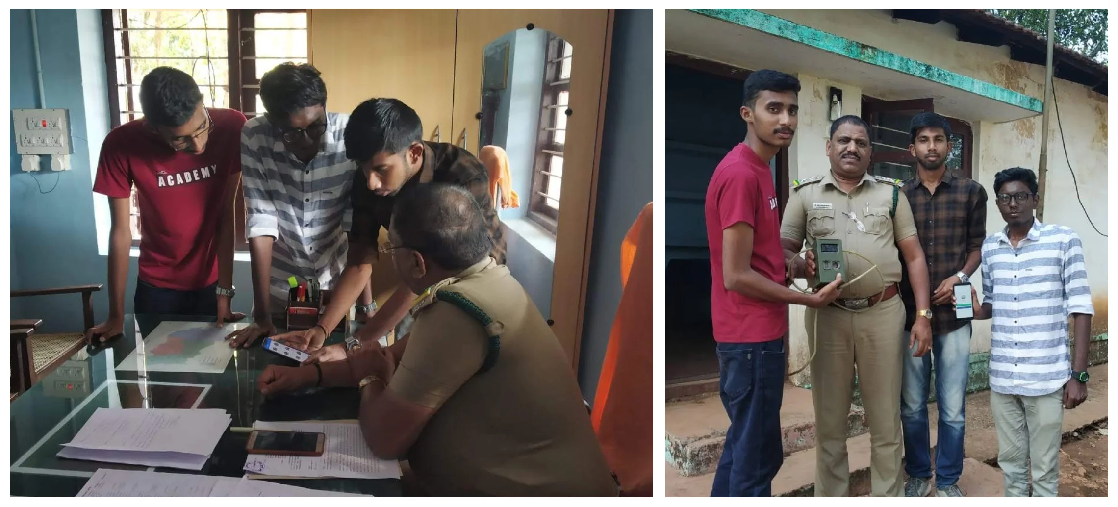
Living with the people in the environment greatly facilitated our empathy with the users, enabling us to identify the best-case solutions for them. Additionally, speaking their regional language provided an added advantage, allowing us to gather more meaningful and qualitative data from locals and officials.
While the current prototype shows promise in detecting elephants, the implementation and testing in the environment are pending as it requires specialized professionals and incurs additional costs, pushing it to the project's next phase.


